Languages and People
In the same way that people are shaped by their environment, languages are shaped by their environment. This understanding led to the creation of Angkelar, a fictional world in which languages could grow, its map is being used to help inspire development of Shacerthan, Mwanithra, and Kinukibeo.
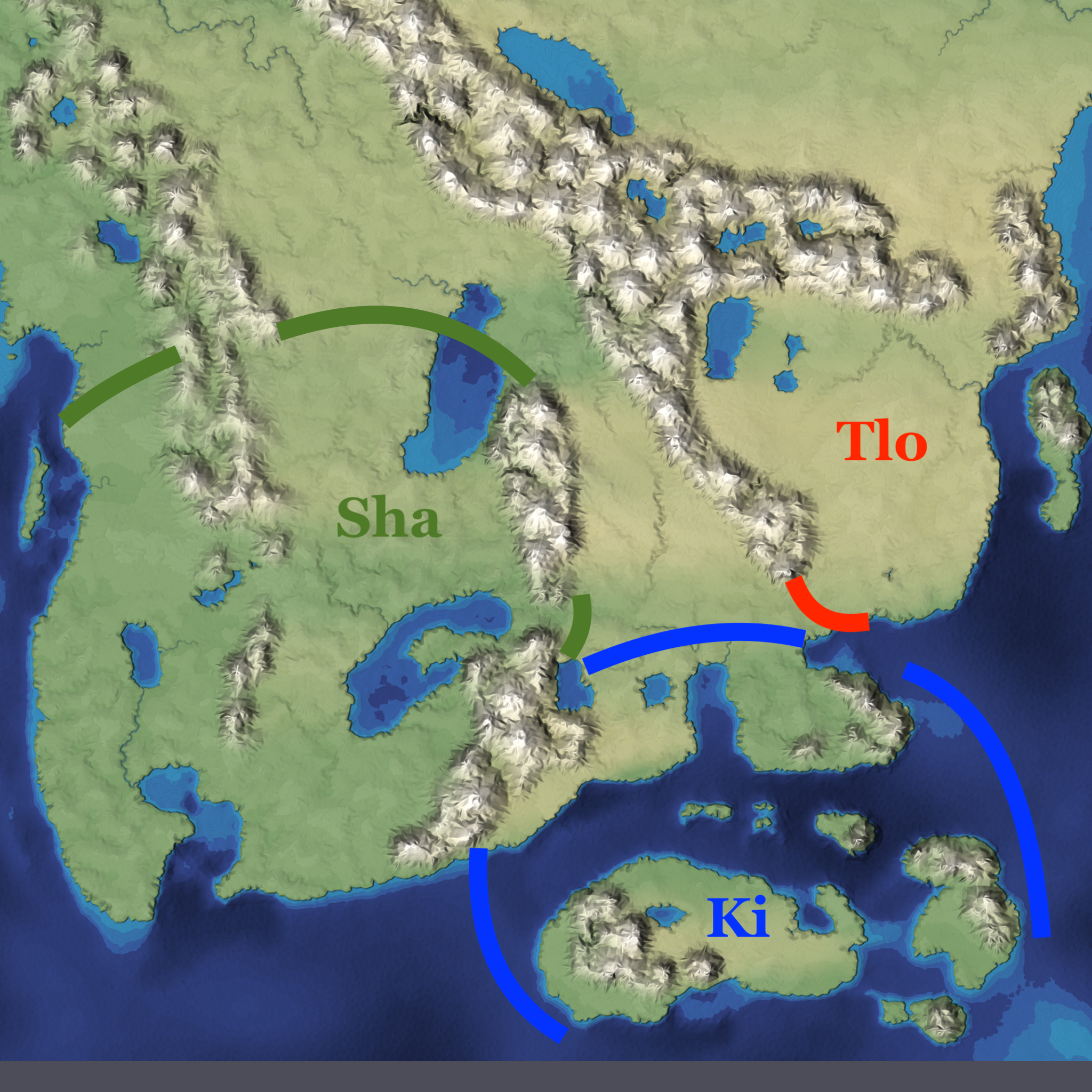
The Map
The map represents a zoomed-in view of a portion of Angkelar and is far from final - nor is it accurately drawn in consideration of scale, geomorphology, limnology, island formation and more. Eventually, things will be re-drawn to better reflect such considerations.
For now, despite its many shortcomings, the map can serve its purposes related to languages .
The People of Angkelar
The Shacer people occupy the more fertile lands in west of the map. The central mountain ranges insulate them somewhat from the other cultures. Consequently, they have developed large cities, scaled agriculture, niche job specialization that allows for technological innovations, and a formal, standing military.
The Tloku people live on the steppes in the east of the map. They are a nomadic people with a few permanent settlements along large inland lakes that allow for fishing and small amounts of agriculture. They are also hunters, using horses and the bow to supplement fishing and agriculture.
The Kibeo people are a seafaring people, living on islands southeast of the map. Beyond the island, they control a small portion of the southeast map. They rely heavily on fishing, but are also skilled in certain forms of agriculture, with different crops being grown on the islands versus mainland.
Beyond these three main cultures, many smaller-yet-influential peoples occupy Angkelar.
Mapping tool used: Mapgen4